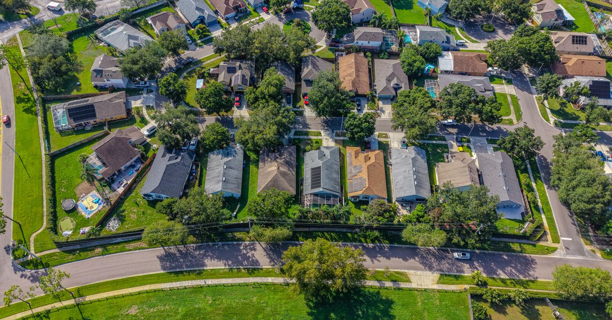
The Jacksonville Westside has no official ZIP code list, because the city does not draw a district by that name. A practical working shortlist for roofers is 32210, 32220 and 32244. Treat those three as a starting point, then confirm every street against a parcel map before you mail or knock, since ZIP edges are approximate.
That sounds like a technicality until it costs you a Saturday. A sales manager who tells a rep to "work the Westside" has given him a direction. A territory needs more than that: a ZIP, a street list, and a reason each house is on it. Here is how to turn a loose name into ground your crew can actually cover.
What is considered Westside of Jacksonville, FL?
Westside is an informal name for the part of Duval County west of downtown and the St. Johns River, and it has no official boundary. The City of Jacksonville organizes its citizen planning committees around six planning districts set by the 2010 Comprehensive Plan. None of the six is called Westside.
Most of what people call the Westside sits in the city's Southwest and Northwest planning districts by our read of the district list, though the city does not label any area Westside. For a roofing company, that cuts both ways. Nobody can tell your rep he strayed out of the Westside, because the Westside has no edge. And nobody can settle an argument between two of your reps about who owns a street, for the same reason.
So you draw the edge yourself. The cleanest way to do it is by ZIP.
Which Jacksonville Westside ZIP codes should a roofer start with?
A workable shortlist for the Westside is 32210, 32220 and 32244. No city or postal source defines the Westside by ZIP, so that list is a working call you make for your own territory, and you can add or drop ZIPs as your crews learn the ground.
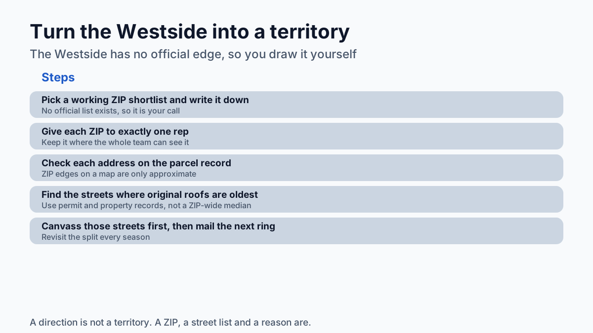
Write the list down. Put it in the same place your reps look for their assignments, and give each ZIP to one person. Three ZIPs split across three reps is a plan. "The Westside" split across three reps is three people knocking the same cul-de-sac in the same week, and a homeowner who now has three business cards on the counter.
If you want the whole county grouped by side of town, that is its own post. This one stays on the west side of the river.
Why don't ZIP code lines match the neighborhoods?
A ZIP Code is a set of mail delivery points, so any shape you see drawn around it on a map is an approximation made afterward. The Census Bureau says it plainly: its ZIP Code Tabulation Areas are generalized areal representations of point-based ZIP Codes.
That has a practical consequence for a mail drop. A house near the edge of 32244 on a map may carry a different ZIP on its actual address, and the reverse is true too. If you pull a mailing list by the shape on a map, some pieces go to homes outside your territory and some homes inside it never get one.
The fix is cheap. Check the property's site address on the parcel record, not the color on the map. For canvassing, the same check keeps a rep from wandering into a neighbor's ZIP because a subdivision entrance happened to sit on the far side of a line.
How old are the roofs in a Westside ZIP?
No reliable single figure exists for the age of homes in any Westside ZIP, and a ZIP-wide number would not tell you which roofs are due anyway. For a rough baseline, the Census Bureau's American Community Survey reports median year structure built in table B25035.
Use that number for what it is. A median for a whole ZIP blends subdivisions built decades apart, so it can describe almost none of the streets in it. And the age of a house is not the age of its roof. A 40-year-old house that was re-roofed eight years ago is not your customer this year, however old the ZIP looks on paper.
Street-level records close that gap. Public building permit records show when a roof was replaced, and property records show when a house was built. Put the two together and you can tell the original roofs from the replaced ones.
| What you need to know | Where to look | What it tells you |
|---|---|---|
| Is this address in my ZIP? | The site address on the parcel record | The ZIP the house actually carries |
| How old is housing in the ZIP? | ACS table B25035 | A ZIP-wide median, useful only as a baseline |
| Was this roof already replaced? | Building permit records | Whether the roof is younger than the house |
What is the best Westside ZIP for a roofer to work?
The best Westside ZIP for a roofing company is the one with the most roofs due and the fewest other roofers already knocking, and you find that out street by street. Rankings of the best or safest ZIPs to live in are written for people moving to Jacksonville. They say nothing about roof age.
Once you have a ZIP, sequence the work. Pull the streets where original roofs have been sitting longest, and send canvassers there first. Mail the next ring out. Door knocking is slow, and mail costs money per piece, so both work better aimed at a short street list than spread across a whole ZIP.
Say you have two canvassers free on Saturday mornings. Forty doors each, on streets you chose because the roofs there have never been permitted for replacement, is a better use of that morning than a ZIP-wide mailer that lands on new roofs and old roofs alike. The canvassers also come back with notes: which houses have tarps, which streets already have a competitor's yard sign, which homeowners asked for a quote.
Shared leads and lead sites have a place in this too. They are fast, and plenty of good roofers buy them. But the homeowner who filled out the form has usually called more than one company. The homeowner on your street list has not called anybody yet, which is why owned prospecting on the Westside is worth the extra legwork.
How do you keep two reps out of the same Westside streets?
Assign each Westside ZIP to exactly one rep and keep that assignment written where the whole team can see it. A region with no official boundary invites overlap, so the boundary has to live in your own records.
Revisit the split every season. If one rep has worked 32220 hard and the remaining streets have newer roofs, move him to a fresh ZIP before he starts re-knocking doors that already said no. Mapping those ZIPs into clean sales territories is a separate walk-through; the rule underneath it is one rep, one ZIP, no shared streets.
If you want to see what one of these ZIPs holds, Roof Identifier will send a free ZIP Roof Report for your ZIP, and Territory Lock keeps a ZIP to one roofing company while it is yours.
Frequently asked questions
Is there an official list of Westside Jacksonville ZIP codes?
No. The City of Jacksonville plans around six numbered planning districts set by its 2010 Comprehensive Plan, and none is named Westside, so any Westside ZIP list is a working call a roofer makes for their own territory.
Can I trust a ZIP code boundary map for a mail drop?
Treat it as approximate. The Census Bureau's ZIP Code Tabulation Areas are generalized representations of point-based ZIP Codes, so homes near an edge should be checked by their actual site address.
Where can I find the age of homes in a Westside ZIP?
The American Community Survey's table B25035 reports median year structure built for a ZIP, which is only a rough baseline. Building permit records show whether a specific roof has already been replaced.
Should a roofer skip a Westside ZIP because of its reputation?
A ZIP's reputation or its ranking as a place to live says nothing about roof age. Pick ZIPs by where roofs are due and how many other roofers are already working the streets.